9 Best GIS Certification Courses - Learn Geographic Information System Online
Highly curated GIS Certification Courses for beginners. Start with the GIS Certification Courses and learn GIS online as a beginner.

What is GIS Certification?
Geographic Information Systems (GIS) is a structure for gathering, overseeing, and examining information. Established in the study of topography, GIS coordinates numerous kinds of information. It investigates the spatial location and sorts out layers of data into representations utilizing guides and 3D scenes.
Knowledge of GIS is an increasingly sought-after skill in industries from agriculture to public health. The underlying motivation for GIS is to ensure you can put spatial data analysis into practice today.
Why GIS is important?
Today, GIS is an important tool for many industries, from natural resources to urban planning. It is important because it allows us to visualize, analyze, and interpret data in a spatial context. We can use GIS to identify patterns, relationships, and trends in data that would otherwise remain hidden. Additionally, it allows users to create interactive maps, enabling users to navigate, query, and analyze data quickly and efficiently. The GIS provides accurate, current information that assists in making informed decisions.
Top GIS Certification Courses List
Disclosure: Coursesity is supported by the learner's community. We may earn an affiliate commission when you make a purchase via links on Coursesity.
1. Core Spatial Data Analysis: Introductory GIS with R and QGIS
Become Proficient In Spatial Data Analysis Using R & QGIS By Working On A Real Project - Get A Job In Spatial Data.
In this course, you will learn how to:
- have greater clarity of basic spatial data concepts and data types.
- carry out practical spatial data analysis tasks in freely available software.
- understand the kind of questions that are answered through spatial analysis and where to obtain free spatial data.
- analyze spatial data using both R and QGIS.
- process raster and vector data in both R and QGIS.
- show off your skills & gain experience by working on a real-life conservation-related spatial data analysis project.
- start analyzing spatial data for your own projects using two powerful freeware tools.
The course includes:
- Introduction to Spatial Data Analysis
- Working with Raster Data
- Working with Vector Data
This course will give you a practical hands-on experience of working with real-life spatial data and understanding what kind of questions spatial data can help you to answer.
This is a core course in spatial data analysis, i.e. you will focus on learning the most important and widely encountered spatial data analysis tasks in both R and QGIS
It is a practical, hands-on course, i.e. you will spend a tiny amount of time dealing with some of the theoretical concepts related to spatial data analysis. However, the majority of the course will focus on working with the spatial data from the Tam Dao National Park, Vietnam.
- Course rating: 4.8 out of 5.0 (4,430 Ratings total)
- Duration: 31 Hours
- Certificate: Certificate of completion

2. Geographic Information Systems (GIS)
Learn Geographic Information Systems (GIS) from the University of California. This specialization will teach the skills you need to successfully use GIS software in a professional setting. You will learn how to analyze your spatial data, use cartography techniques to communicate your results in maps, and collaborate with peers in GIS and GIS-dependent fields.
In this course, you will learn how to:
- create and work with raster data.
- develop and analyze data for the geospatial analysis project.
- develop a large processing workflow in ModelBuilder.
- interpret and explain the results you obtained in comparison to your original GIS question and/or hypothesis.
First, you will explore the world of spatial analysis and cartography with geographic information systems (GIS). You will learn the basics of the industry’s leading software tool. You will learn how GIS grew from paper maps to the globally integrated electronic software packages of today. You will install ArcGIS on your computer and learn how to use online help to answer technical questions.
Next, you will open up ArcGIS and explore data using ArcMap and also learn the foundational concepts of GIS, how to analyze data, and make your first map. Here, you will make your own maps by symbolizing data and creating an eye-catching final product. You will share your data and maps and learn how to store and organize your data. By completing the first section of this course you will gain the skills needed to succeed in the full program.
Second, you will go in-depth with common data types (such as raster and vector data), structures, quality, and storage. Initially, you will learn about data models and formats, including a full understanding of vector data and raster concepts. You will also learn about the implications of a data scale and how to load layers from web services.
Third, you will learn to create a vector data model by using vector attribute tables, writing query strings, defining queries, and adding and calculating fields. You will also learn how to create new data through the process of digitizing and you will use the built-in Editor tools in ArcGIS.
Fourth, you will learn about common data storage mechanisms within GIS, including geodatabases and shapefiles. You will also learn how to choose between them for your projects and how to optimize them for speed and size.
Here, you will also work with rasters for the first time, using digital elevation models and creating slope and distance analysis products. Moreover, you will explore datasets and assess them for quality and uncertainty.
Additionally, you will learn how to bring your maps and data to the Internet and create web maps quickly with ArcGIS Online. Take GIS Data Formats, Design, and Quality as a standalone course or as part of the Geographic Information Systems (GIS) Specialization.
Finally, you will design and execute a complete GIS-based analysis – from identifying a concept, question, or issue you wish to develop, all the way to final data products and maps that you can add to your portfolio.
- Course rating: 4.8 out of 5.0 (5,331 Ratings total)
- Duration: 31 Hours
- Certificate: Certificate of completion


3. Using Open Source Tools to Create an Enterprise GIS
This easy-to-follow, hands-on course addresses the high costs and complexity of implementing a multi-user enterprise GIS by teaching students how to build a GIS from scratch using Postgres and PostGIS (free). It will help you create an enterprise GIS with Postgres SQL, QGIS, and PostGIS to manage users and support multiple GIS software clients.
In this GIS course, you will learn the following:
- Install PostGRES and PostGIS.
- Design a PostGRES database with multiple users and roles.
- Load GIS and attribute data into PostGRES and PostGIS.
- Manage data by including constraints, views, and indexes.
- Connect GIS software as clients to the Enterprise PostGRES database.
- Perform simultaneous multi-user editing of GIS data.
- Issue spatial and non-spatial SQL to perform geographic analysis.
- Develop an external application (kiosk) in Python.
- Publish enterprise data on the Internet.
During this course, you will create an Enterprise GIS with vector and raster data for a mid-sized city. It will teach you how to add users with different permissions for accessing and editing data, and control database access, presentation, and editing with PostGRES. In addition, you will learn how to manage multiple users concurrently on the same GIS layer.
- Course rating: 4.5 out of 5.0 (890 Ratings total)
- Duration: 3 Hours 30 Minutes
- Certificate: Certificate of completion

4. Fundamentals of GIS
Explore the world of spatial analysis and cartography with geographic information systems (GIS). Initially, you will cover course expectations, receive a quick overview of GIS and what's great about it, take a first look at ArcGIS and identify critical elements in the interface, and define core geospatial concepts and terminology.
In this course, you will learn how to:
- define core geospatial concepts.
- practice with subset data using selections and feature attributes.
- create map books using advanced mapping techniques.
- create layer and map packages.
- GIS grew from paper maps to the globally integrated electronic software packages of today.
- install ArcGIS on your computer and use online help to answer technical questions.
- open up ArcGIS and explore data using ArcMap.
- understand the foundational concepts of GIS, how to analyze data, and make your first map.
- make your own maps by symbolizing data and creating an eye-catching final product.
- store and organize your data by sharing your maps and data.
Next, you will discuss options for desktop GIS, the history of GIS and how it is used today, discuss resources and help that you can use, and lay out core skills that are relevant to you as a GIS analyst. This part will close out by showing you how to get a copy of ArcGIS for this course, and with a tutorial on getting started in ArcGIS.
Next, you will explore GIS data using ArcMap and will explore and change the properties of GIS layers to change map displays. We will subset data using selections, and explore feature attributes. Finally, we will learn about projections and use that knowledge as we run geoprocessing tools.
You will learn how to identify common datasets in both the US and Internationally. You will learn how to use a new mode in ArcGIS to create complete maps that include proper symbology, legends, titles, north arrows, and data sources. You will also use more advanced mapping techniques to output map books and label items on the map.
Finally, you will learn how to view and edit metadata in order to create higher-quality data. The course will retrieve data from the web and share data, discuss workspaces and file formats, and create layer and map packages.
Lastly, you will also learn how to use multiple file formats for GIS data and be able to choose between them based upon project requirements appropriately.
- Course rating: 4.8 out of 5.0 (4,430 Ratings total)
- Duration: 31 Hours
- Certificate: Certificate of completion

5. An introduction to GIS and QGIS 3
Learn the fundamentals of GIS and get comfortable with the QGIS interface.
In this course, you will learn how to:
- understand the fundamental principles of GIS.
- be familiar with GIS terminology.
- use the basic functions of QGIS.
This course is an introduction to GIS and QGIS. Starting at the beginner level, you will cover basic terminology and conventions, some of the fundamental principles of GIS, and an overview of what QGIS is and then you will get started with practical experience of using QGIS.
- Course rating: 4.2 out of 5.0 (767 Ratings total)
- Duration: 1.5 Hours
- Certificate: Certificate of completion

6. Learning QGIS
Enrich your GIS data and make more effective maps with QGIS, an open-source GIS software.
In this course, you will learn how to get QGIS up and running on your computer and create both 2D and 3D maps with vector and raster data. You will learn to stylize maps, get more insights from data with overlays and heat maps, and publish results with powerful Python-driven plugins for QGIS.
The course includes:
- Understanding and Installing QGIS
- Vector Data with QGIS
- Raster Data with QGIS
- 3D Maps
- Styling Data
- Labeling Features
- Changing Default Properties
- Printing with Print Layout
- Creating New Data
- Using Advanced Tools
- Using Plugins
- Python in QGIS
This course shows how to get QGIS up and running on your computer and create both 2D and 3D maps with vector and raster data. Plus, learn how to stylize maps, get more insights from data with overlays and heat maps, and publish results with powerful Python-driven plugins for QGIS.
- Course rating: 28,795 total enrollments
- Duration: 1.5 Hours
- Certificate: Certificate of completion
- View course
7. Introduction to GIS: Spatial Data Analysis with QGIS
Learn GIS, spatial analysis, and web mapping, and complete hands-on GIS projects with QGIS.
In this course, you will learn how to:
- install QGIS and Google Earth Engine.
- import CSV and GIS data into QGIS.
- understand the projection and coordinate systems.
- download and map raster data from a public repository.
- differentiate between vector and raster data.
- perform a spatial query with tabular data.
- perform point pattern analysis.
- generate Heatmap using Kernel Density Algorithm.
- create and share online maps using web GIS platforms.
- perform various spatial analyses including buffer, joins, clipping, and other spatial analyses.
- complete a final GIS project on downloading, processing, analyzing, and visualizing geospatial data.
This course will help you get up and running QGIS software. By the end of this course, you will not only master the theoretical concepts of s geographic information systems but also most importantly equipped with a set of new GIS skills including accessing, processing, analyzing, visualizing, and sharing spatial data.
One of the common problems with learning GIS is the high cost of the software. In this course, you will entirely use open-source free software. Additionally, the course will walk you through a step by step video tutorials to handle GIS data in the QGIS platform.
- Course rating: 4.2 out of 5.0 (767 Ratings total)
- Duration: 1.5 Hours
- Certificate: Certificate of completion

8. Introduction to GIS for Developers
Developers are using geographic information systems (GIS) to visualize, analyze, and interpret location information already present in their data. This course introduces GIS concepts, demonstrates GIS workflows in code, and explores GIS resources.
In this course, you will learn:
- how to find authoritative GIS data, or create your own.
- explore techniques for visualizing GIS data on an interactive map.
- how to analyze GIS data to expose spatial relationships and trends.
- sharing GIS data and apps can increase their value for solving real-world problems.
The course includes:
- The "What" and "Why" of GIS
- Creating or Acquiring GIS Data
- Visualizing Spatial Patterns
- Analyzing Spatial Relationships
- Sharing Your GIS Solutions
In this course, Introduction to GIS for Developers, you will learn how a geographic information system (GIS) can be used to reveal patterns hidden in the location information of a dataset.
- Course rating: 4.5 out of 5.0 (39 Ratings total)
- Duration: 2 Hours
 Jason Hine
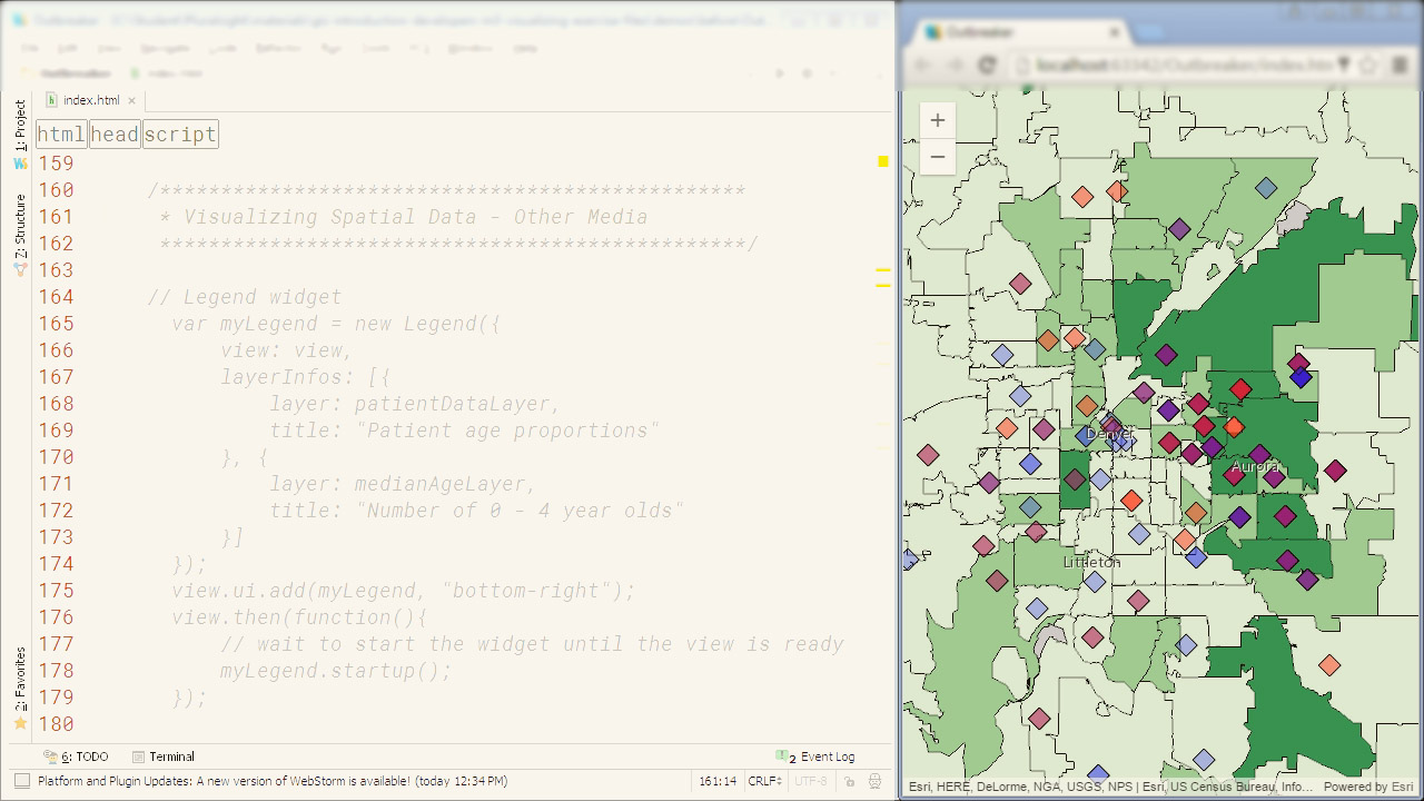
9. ArcGIS Pro Essential Training
Learn how to conduct analysis and create professional 2D and 3D maps with ArcGIS Pro.
The course includes:
- Understanding ArcGIS Pro
- Vector Data
- Raster Data
- Styling Data
- Labeling Features
- 3D Maps
- Printing with Map Layouts
- Creating Data
- Geospatial Tools
- Sharing Data
This course teaches you the essentials of working with ArcGIS Pro 2.4. It shows how to navigate maps and create new projects from a variety of ArcGIS templates. It also demonstrates how to select and edit individual map elements, and connect to advanced geospatial data sources.
Next, the course explains the finer points of working with vector vs. raster data and then shows how to style and label your maps. Plus, you will learn how to publish your projects to ArcGIS Online for sharing and collaboration.
- Course rating: 65,179 total enrollments
- Duration: 2.4 Hours
- Certificate: Certificate of completion
- View course
Thank you for reading this. We hope our course curation would help you to pick the right course to learn GIS Certification. In case you want to explore more, you can take the free GIS Certification courses.
Hey! If you have made it this far then certainly you are willing to learn more and here at Coursesity, it is our duty to enlighten people with knowledge on topics they are willing to learn. Here are some more topics that we think will be interesting for you!